Avalanche danger ‘high’ as storm dumps snow, wind on Tetons
JACKSON (WNE) — The Bridger-Teton Avalanche Center has raised the avalanche hazard to “high” in upper elevations as a winter storm brings heavy winds and snow to Jackson Hole.
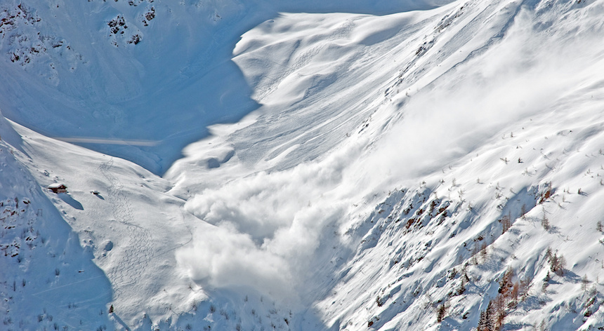
“Use cautious route finding as natural avalanches are likely in the upper elevations,” forecaster Alex Drinkard wrote in the Monday morning forecast. “Ride low angle terrain during this storm cycle as continued snowfall with strong wind throughout the day increases avalanche danger to high.”
At the same time, Teton Pass remains open to commuters.
The Wyoming Department of Transportation advises drivers to “proceed with caution” between Wilson and the Idaho state line. There will be narrow travel lanes over the pass, but travel conditions may deteriorate.
The Avalanche Center bumped the hazard rating up after the storm began blowing in with a 31 mph average wind speed. It dropped 12 inches at Jackson Hole Mountain Resort’s mid-mountain Chief Joseph plot, 10 inches in Grand Teton National Park’s slightly higher Surprise Meadow plot, and 4 inches in the resort’s summit-top Rendezvous Bowl plot.
The max wind speed recorded was 65 mph.
Those winds have created wind slabs 3 to 4 feet deep that will be sensitive to human triggers, Drinkard wrote.
As the storm continues, forecasters are also warning that the new snow may re-awaken the persistent slab, a layer of weak snow buried deep in the snowpack that has the potential to cause large avalanches. The layer of concern is weaker snow that developed after a huge Jan. 26 storm. That layer is buried 2 to 3 feet deep in the snowpack.