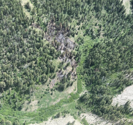
Alpine, Wyo., May 24, 2018 – The Bridger-Teton National Forest is continuing to work with consultants and partnering agencies to get contractors, funding, equipment and personnel lined up to work, as soon as it is effective and safe to do so, on the Porcupine Landslide. The nearly 25-acre landslide, located 17-miles from Alpine, Wyoming is comprised of roughly 500,000 cubic yards of earth which has slid over a quarter mile stretch of what used to be the Greys River Road before it was destroyed by the slide. There is a little over 1 million tons of earth that still hasn’t stabilized and is subject to many unknown variables caused by the approaching spring runoff. “We still haven’t hit peak run off and while the slide is still moving, it has slowed down since last month,” said Greys River District Ranger Justin Laycock.
The landslide created an earthen debris dam that blocked the Wild and Scenic eligible Greys River and has impounded approximately 14-vertical feet of water behind the unstable dam. “The fact that the landslide is still unstable and that the Greys River is continuing to carve a new channel to the west of the debris dam created by the landslide has not stopped the Bridger-Teton, or its partners, from getting everything lined up so work can begin as soon as it is possible to enter the area and make effective changes,” Laycock said. “Last week we had an excavator on site, improving drainage and helping natural water flow in order to help get the area ready for drill pad installation so we are in position to start work on dewatering the site,” he said.
Simplot, Smoky Canyon Mine, has donated a D6 bulldozer and operator to construct drill pads and drill road for the coming geotechnical drilling operations. “While there is no way to determine when this work can occur until after spring runoff occurs and weather remains favorable, the promise of skilled operators and sufficient equipment will be incredibly valuable to progress on building a new Greys River Road,” Laycock said.
Lincoln County provided transportation for the bulldozer, and will also provide return transport for the equipment. Wyoming Department of Transportation (WYDOT) has agreed to drill the site, and will provide drill logs to the design team. “We have a planning meeting with the design team on the May 29, and a site visit planned for May 30 to discuss how to best move forward,” Laycock stated. “We plan to work with Lincoln County to acquire additional 3D imagery with another unmanned aerial system (UAS) flight on the site visit on the 30th as well,” he said. The Forest has negotiated for a quick turn-around on the design following the site visit. The next step would be awarding the contract and then beginning ground work as soon as weather, runoff and conditions allow for the operators to begin.
Bridger-Teton employees are regularly visiting the landslide and monitoring changes in the condition. Additionally impacts to the river and the amount of water being retained by the debris dam are being monitored by river gauges above and below the slide. Web-camera installation and remote monitoring has been ongoing for nearly a month where experts are able to track changes on the slide with photographs delivered every three hours. The Forest has also partnered with Contour Aerials and Lincoln County, Wyoming to obtain aerial views of the landslide via an UAS flight which was conducted on April 19th. Idaho State University has received a grant and they are allocating students to help with research regarding the slide activity. These students will be adding ground monitoring pins to the slide in order to monitor the slides activity. This will help with data retention and to monitor how the slide is progressing.
Although the Alpine access and the Greys River Corridor is closed for 10 miles between the Little Greys River road through Porcupine Road, visitors still may access the Forest beyond the closure by three other routes. (1) either by the Smith’s Fork, Forest Service Road 10072, road located South of Afton or (2) through Forest Service access from Big Piney, WY (proceed to Ryegrass Junction to Forest Service Road 10125, also known as N. Cottonwood, then over McDougal Gap to Greys River Road) and (3) The La Barge Road accessed from the town of La Barge, Wyoming. The Bridger-Teton National Forest contracted to have the McDougal Gap access plowed open. While the route is clear it is still extremely wet and only high clearance vehicles are recommended due to the amount of remaining snow along the banks and the soggy conditions.
The landslide occurred on February 8, 2018 approximately 17-miles up the Greys River Road near Alpine, Wyoming. The quarter-mile long landslide destroyed the Greys River Road replacing it with a mountainside. A closure order is in place for the 10-mile corridor from the Little Greys River Road to the slide area. While there is still risk to recreationists along the Greys River Road below the slide if the debris dam fails, the Forest has identified no camping areas along the lowest lying portions of the route and has commitment from Lincoln County to assist in rapid evacuation of the corridor in event of the flooding emergency.

