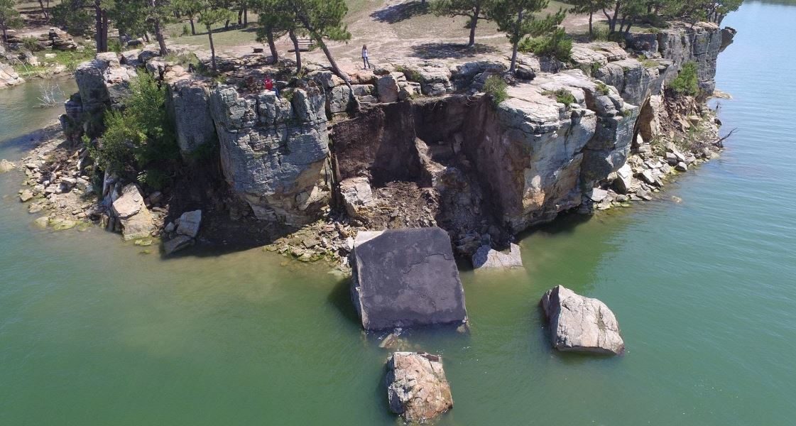
The geology of Keyhole State Park, in the Black Hills region of northeast Wyoming, preserves the story of Wyoming’s Jurassic and Cretaceous past, a time when much of the state was under water. This geologic history is detailed in a new information pamphlet published by the Wyoming State Geological Survey (WSGS). The pamphlet is the fourth in a series about Wyoming’s state parks.
“The goal with this series is to enhance visitors’ experience by interpreting the geology they see while exploring Wyoming’s state parks,” explains WSGS Director, Dr. Erin Campbell. “The rocks at Keyhole are an excellent record of the environmental changes during Cretaceous time, and hopefully this pamphlet will help visitors to imagine what it was like here more than 75 million years ago.”
The pamphlet includes a geologic map and a stratigraphic chart depicting the geologic formations exposed in the park. There is also an overview of Keyhole Reservoir. The 37,000-acre reservoir on the Belle Fourche River is the largest body of water in northeast Wyoming.
“I think the most interesting part of this park is the Pine Ridge Anticline, a fold in the rocks that exposes the Jurassic through Lower Cretaceous sedimentary rocks in the center of the park,” says WSGS geologist Dr. Jesse Pisel. “It makes for a picturesque way to look at the geology.”
Information pamphlets are available for Keyhole, Guernsey, Seminoe, and Curt Gowdy state parks at the WSGS office on the University of Wyoming campus in Laramie and as free downloads from the Survey’s website.