By Dustin Bleizeffer, WyoFile.com
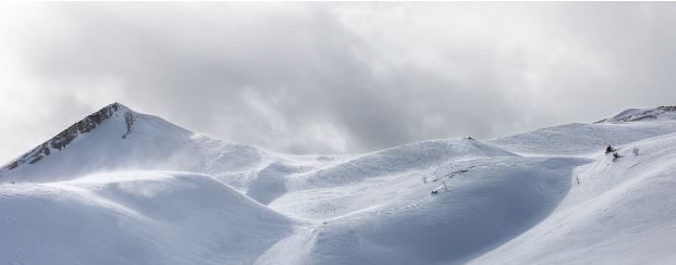
Forecasters say Wyoming is likely in store for “normal to below normal” snowpack this winter and early spring, bringing little drought relief.
The state enters winter with all four major basin regions below-median snowpack for this time of year, while soil moisture also remains below average for much of the state, according to the November Wyoming Hydraulic Update and Outlook published by Natural Resources Conservation Services. Although October was wetter than normal, those gains were diminished by a mostly dry and unusually warm November and first week of December which saw high temperatures smash 100-year records.
“We have a lot of conditions to overcome,” Casper-based Natural Resources Conservation Services hydrologist Jim Fahey said. “Going back to the low-soil moisture that we’ve seen, and low base flows in the rivers and a two-year drought as well, we could definitely use an above-average winter.”
The trends underscore long-term challenges in the state brought by human-caused climate change, which pose major impacts for agriculture, river flows and other factors.
The current La Nina event will continue through the winter months, and could usher in above-average amounts of precipitation for the northwestern portion of the state. Overall, Wyoming has about equal chances for slightly above or slightly below normal temperatures and precipitation this winter, according to Jackson-based Mountain Weather meteorologist Jim Woodmencey.
“If we come out of this close to normal precipitation and near-normal temperatures, I’d be happy with that,” Woodmencey said.

Just three Wyoming ski resorts had opened as of Monday: Jackson Hole, Grand Targhee and Snowy Range, according to the On The Snow ski report. At least five others plan to open within two weeks. Wyoming ski resorts historically aim to open on or before the Thanksgiving holiday.
Jackson Hole Mountain Resort reported four of 13 lifts open, including the Sweetwater gondola, with a season total of 101 inches of snow at upper elevations. Grand Targhee reported a season total 113 inches of snow, or just 23% of its season average so far.
“We’ve had a really good run of above-normal snowfall winters the last five years running in the town of Jackson and then in the mountains and Jackson [Hole] Ski Resort,” Woodmencey said. “The snowpack season, or water season, starts October 1. So normally we’d have quite a bit more on the ground by now, and it just hasn’t kicked in yet. But that can change in a matter of a week or two.”
Hogadon near Casper hopes to open Dec. 19, and Sleeping Giant ski area near Cody announced Tuesday morning it is pushing back its opening date indefinitely, until there’s enough snow. “We have done everything we can on our end to make enough snow so that our guests can have a fun time,” Sleeping Giant Mountain Operations Manager Chris Mackie wrote in an email update to subscribers. “Even with the incredible equipment we have on hand, the outdoor temperatures still have to be just right for our efforts to be successful.”
The National Weather Service’s 72-hour snow accumulation report on Monday showed a range of 1-18 inches of snow across the state, with the heaviest snowfall favoring the western mountains. The western portion of the state should see more accumulations of snow this week, according to the NWS Riverton office, while high winds continue to dominate the outlook east of the Continental Divide.
“Here, the main concern is wind as it seems someone has hidden the off button for the relentless Wyoming Wind Machine,” NWS Riverton reported on Monday.
Winds have hammered much of central and eastern Wyoming for several days, forcing closures on parts of Interstates 25 and 80. A 118 miles per hour wind gust was reported near Clark while wind gusts over 50 mph were reported at 15 locations in the central part of the state over the weekend, according to the NWS Riverton office.
Wyoming’s average temperature in November was about 6 degrees Fahrenheit warmer than average, according to the National Oceanic and Atmospheric Administration, and several areas of the state broke high temperature records that had stood for more than a century.
Wyoming is in the second year of a “moderate to severe” drought that has parched much of the West. Climate scientists warn the western U.S. is already seeing signals that modeling indicates will be a dramatic, irreversible change in climate. Mountainous states in particular will likely see long periods of “low to no snow” beginning in the 2050s, according to a new study published in Nature Reviews Earth and Environment.
The stakes are only increasing in Wyoming, where winters and springs are warming at an alarming rate — an average 2.8 degrees Fahrenheit and 2.9 degrees Fahrenheit respectively since 1920, according to NOAA data. Geographically, Wyoming’s highest elevations — where snowpack matters most because it drives spring runoff — have seen greater warming impacts than the rest of the state in recent decades despite year-to-year variances in weather.
January precipitation in the Greater Yellowstone Region has decreased by about 0.5 inches, while June precipitation has decreased by about a third of an inch, according to Bryan Shuman, director of the University of Wyoming-National Park Service Research Center in Grand Teton National Park, a lead author of the Greater Yellowstone Climate Assessment.
“Given the limited amount of total precipitation some parts of the region experience, [the seemingly small decrease] is actually meaningful,” Shuman said during a Greater Yellowstone Climate Assessment webinar Dec. 9. “But it’s not that there isn’t precipitation. It’s falling instead in spring and fall, so we are seeing a shift in when water is available to us for various purposes and when the water is reaching our ecosystems.”
Spring 2021 brought one of the lowest runoff seasons in 45 years, exacerbating a well-below average runoff year in 2020, according to the November Wyoming Hydraulic Update and Outlook.
Many places east of the Continental Divide in Wyoming receive 55% to 65% of annual precipitation during the spring season, according to Fahey, author of the Hydraulic Update and Outlook.
“That drastically affects the amount of runoff,” Fahey said. “If we have too much, and if we have rain-on-snowmelt, that’s a recipe for flooding in this part of the world. So add that in the mix, too.”
Most of Wyoming appeared to emerge from drought conditions in 2014, with several “decent” precipitation years before re-entering drought conditions again at the end of 2019.
“Our runoff is snowpack-dependent, of course,” Fahey said. “75% to 80% of our water every year comes from melting snowpack.”