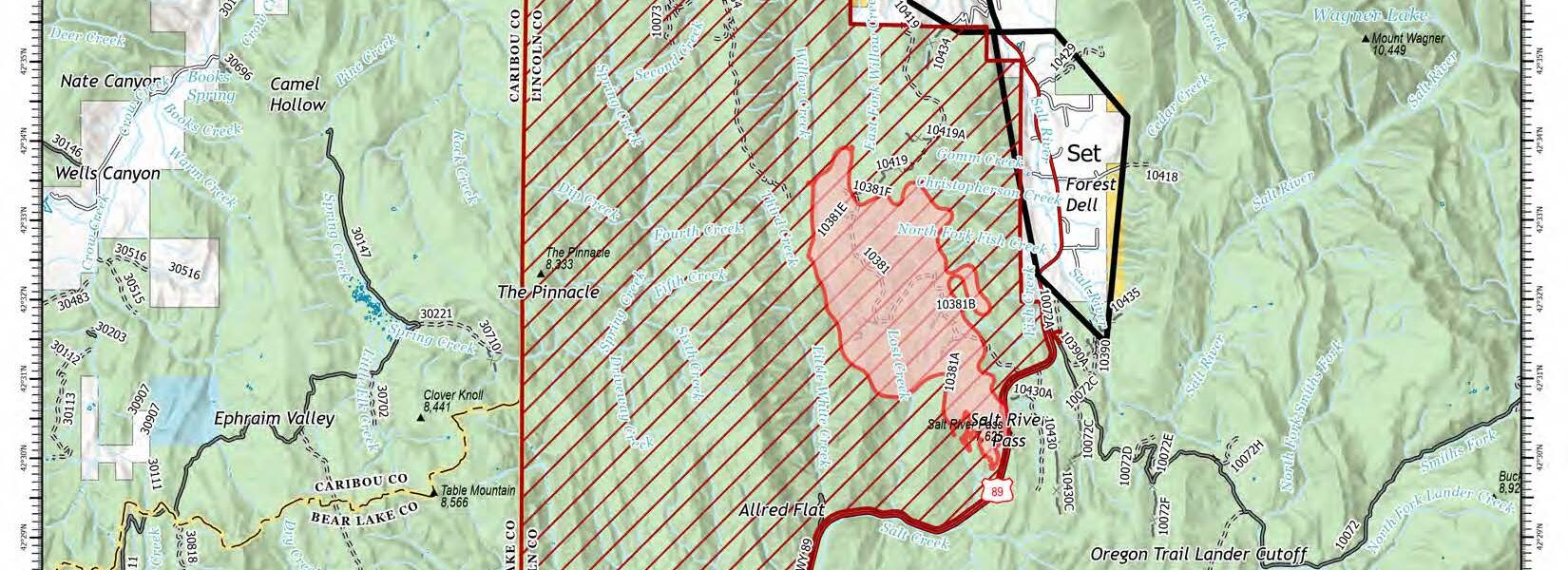
Willow Creek Fire now considered 4,063 acres at 23% containment
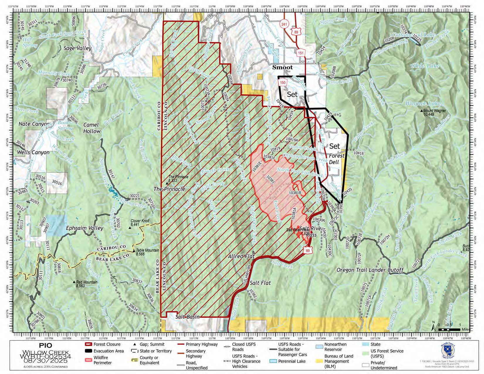
According to the most recent update from officials with the Bridger-Teton National Forest, the Willow Creek Fire enters its second weekend now being described at 4,063 acres in size and at 23% containment.
The fire was first reported on Friday, August 22, approximately four miles southwest of Smoot and grew to over 3,500 acres by last Saturday night, causing a temporary closure of U.S. 89 and evacuations of some residents near the mountain.
A total of 326 people have been assigned to the fire over the course of the last eight days.
Officials gave the following update:
“As conditions cleared on Friday, fire behavior increased compared to previous days. Hot spots and interior heat persisted through the cool wet weather. To access the interior and western perimeter of the fire, operations to improve the 381 Road have been completed. This allows for efficient transport of resources to every division of the fire. Today crews on all divisions are engaging directly to extend established fire containment lines. Resources are spread out along the fire’s edge and will be constructing fireline simultaneously. Helicopters will continue to assist firefighters on the ground with supply drops and dropping water as necessary. Division Tango continues to assess structures north of the fire. Pumps, sprinklers, and hose lays are being installed as a precautionary measure if the fire spreads to the north.”
After a very rainy week there was some concern about fire behavior with increased winds expected this weekend. Officials offered their views on the weather forecast:
“Mostly clear skies all day, with no rain expected on Saturday. Temperatures and RHs Saturday will be similar to Friday, with a high in the mid-60s and minimum RHs around 30 percent. Winds will be out of the north around 10MPH with gusts up to 15MPH. Looking ahead, temperatures trend warmer Sunday through Tuesday, with humidity trending slightly down. Along with this trend fire behavior is expected to remain active with potential increases in activity and smoke.”
• EVACUATION/CLOSURE INFORMATION


1 COMMENTS
Comments are closed.