Post Views: 2,892
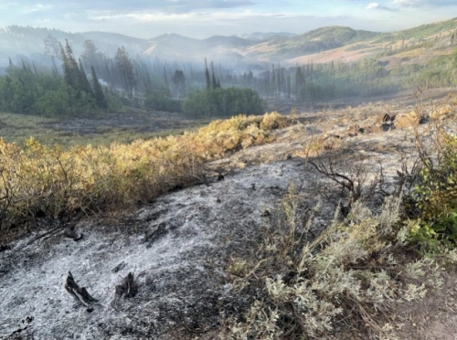
A full week into the Willow Creek Fire, officials are describing the blaze at 23% contained. The size of the fire has not changed per the latest information and is still at 4,356 acres. The fire was first reported on Friday, August 22 at just after 11 a.m. and crew to over 3,000 acres by last weekend. U.S. Highway 89 was temporarily closed and some residents southwest of Smoot were evacuated.
Residents west of Highway 89 from Reeves-Schwab Lane South to Gomms Pond as well as all residences from milepost 75 south to Salt Pass are still being asked to remain in “Set” status in case fire behavior requires a “Go” order is given.
A community meeting will take place at the Afton Civic Center on Friday night at 7 p.m. Officials will provide updates on the current fire behavior. Fire managers and local agency representatives will be on site to answer questions.
Crews focused on the eastern edge of the fire, strengthening the perimeter heading north with hand crews building line, and clearing vegetation. Structural protection efforts continued along the eastern edge. In addition, road 381 being improved to allow crews better access to the fire’s northern perimeter.
WEATHER FORECAST
Isolated and scattered showers are possible Friday. Temperatures will be on the cooler side with highs in the mid to upper 60s. Winds will be variable changing direction to north northwest at 5 to 10 mph in the morning. Generally, conditions will start to clear and will become warm and dry by the end of the weekend. With the rain and clouds clearing, smoke from the fire will become more visible with an increase in fire behavior.
EVACUATION/CLOSURE INFORMATION
The evacuation zones remain at a ‘SET’ status. The zones are from mile post 75 south (vicinity of Gomm’s Pond Lane) to Salt Pass, and west of Highway 89 from Reeves-Schwab Lane South to Gomms Pond. Please be prepared for potential evacuation should the “GO” order be given. The Code Red notification will be initiated by Lincoln County Homeland Security & Emergency Management. Use this link
https://public.coderedweb.com/CNE/en-US/5A0AA8D606C6 to sign up to receive notifications.
A forest closure for a portion of both the Grey River District and Kemmerer District, is still in effect. The defined boundary for area closure is as follows: from U.S. Highway 89 T29 N R 19 N Section 34 running west along the Bridger-Teton National Forest boundary (R19W R18W) to the Wyoming Idaho State line, running north along said state line to the Forest/private boundary at T 31 R 119 W section 30, following the Forest/private boundary SE to its intersection with U.S. Highway 89, running along the west edge of U.S. Highway 89 back to the point of origin. Smiths Fork Winter Trailhead is closed. Within the described area , all roads and trails are closed including Allred Flat Campground. Follow this link for full closure information:
https://inciweb.wildfire.gov/incident-closures/wybtf-willow-creekTravelers on Highway 89 are advised to use caution due to fire vehicles and equipment in the area. Please do not stop or park along the roadside to view the fire area, as this can create safety risks for emergency personnel.
Please monitor local media and follow Lincoln County Homeland Security & Emergency Management on Facebook for more updates.
Let us know what you think!