By Mara Abbott
Buffalo Bulletin
Via- Wyoming News Exchange
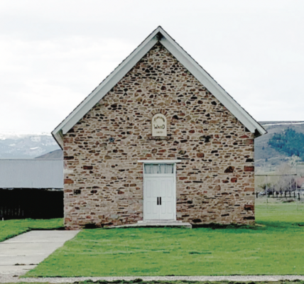
BUFFALO — Wyoming’s parched summer has continued into a dry, unseasonably warm fall and early winter in 2020. That could change soon, said Wyoming Natural Resources Conservation Service hydrologist Jim Fahey.
The 2020-21 winter is shaping up to be a moderate to strong La Niña year, the type that typically brings higher-than-average moisture to northern Wyoming. La Niña is the name for a recurring weather pattern that occurs when oceanic temperatures fall throughout the central and eastern tropical Pacific Ocean.
The dry winter so far doesn’t mean that La Niña’s moisture won’t come.
“It takes awhile to get going,” Fahey said. He referenced the 2016-17 winter, when after a late start, “it didn’t stop snowing ’till March.”
Almost all of Johnson County is in either severe and extreme drought after a warmer-than-average year with precipitation far below average. The drought conditions smothering the entire western United States are expected to persist through at least the end of February, according to the U.S. Drought Monitor.
Through October, the year has been the seventh driest year on record for the county, according to National Oceanic and Atmospheric Administration data.
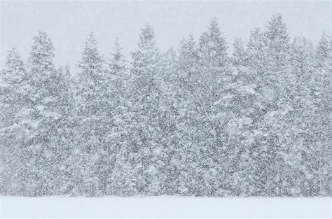
With no measurable precipitation, November offered no help. Early snowpack measurements for the water year, which runs Oct. 1 through Sept. 30, are at 50%-75% of normal across the state.

At this point, forecasting models offer equal chances that the county will see average, above- or below-average temperatures through much of the winter. The northern portion of the county is forecast to see slightly below-average temperatures from January to March.
NOAA models predict slightly above average precipitation in Johnson County through March. April, May and June are traditionally the area’s wettest months, accounting for more than 40% of total annual precipitation.
“That’s what we really rely on to make or break us for whether we’re going to be in a
drought, have a severe fire season, have runoff, and so forth,” Fahey said.
The dry fall could, however, impact how much of that water makes it into the county’s
streams, ditches and reservoirs. Although much of the state had decent snowpack last spring, due to a dry 2019 fall, the soil underneath it was thirsty, sucking up the water as the snow melted. Soil moisture this year was even lower, according to Fahey.
“We’re relying on more snow than usual to give us better runoff,” he said.
The elevation at which that snow falls matters, too.
Over the 17 years Fahey has worked in Wyoming, he has watched the main snowpack move higher and higher. Looking back at data from the 1980s and ’90s, he said, “We had a whole heck of a lot more snow in the lower elevations than we do now.”
That matters for runoff, because mountains, like a sequence of inverted snow cones, are more narrow at the top, Fahey explained, meaning there is less surface area high up for snow to accumulate.
“We are seeing warming earlier in the runoff season,” he said. “It’s optimal for water
supply to hold that snowpack later in the season, like late May or the middle of June. We’ve seen the melt starting in late April, early May, and that’s another reason why we’re not getting as much into the streams and reservoirs.”