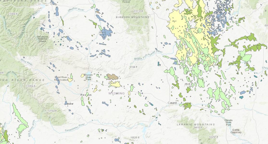
The Wyoming State Geological Survey (WSGS) completed its 2019 update to the Interactive Oil and Gas Map of Wyoming. The updates are done annually to redefine the spatial extent of oil and gas fields by incorporating new wells drilled in the state during the previous year.
In Wyoming, wells are permitted either within a defined field, such as Salt Creek field, or as a wildcat. Until recently, most traditional oil and gas fields were spatially defined by structural or stratigraphic traps that physically hold the oil or natural gas in place. Fields in the Bighorn Basin are good examples of these traps, where most fields are anticlines, or arch-shaped folds, that trap oil. Operators typically use vertical wells to produce from these fields.
Wildcat wells are defined by the Wyoming Oil and Gas Conservation Commission as “wells outside known fields or new wells which are determined by the Commission to have discovered oil or gas in a pool not previously proven productive.” Modern drilling technologies, including lengthy horizontal wells and hydraulic fracturing techniques, are now allowing operators to explore for oil and natural gas in previously uneconomic unconventional reservoirswithout well-defined spatial extents.
“These days, especially in Wyoming’s Powder River and Denver basins, production is from tight sand and shale reservoirs where the oil and gas is widely distributed throughout the pore spaces of the rock,” says WSGS oil and gas geologist Rachel Toner. “When the WSGS first published the Oil and Gas Map of Wyoming in 1943, all oil and gas wells were in traditional, named fields. Over the last decade the trend in eastern Wyoming is that wells are increasingly drilled as wildcats. Wildcat well locations and their target reservoirs are so variable that they cannot be combined into a single field.”
Although the 2019 version of the Interactive Oil and Gas Map of Wyoming may not look much different from the outset, a closer look highlights significant activity statewide. Last year, 599 wells were completed in the state. Of these completions, 235 are in the traditional Jonah and Pinedale fields in Sublette County, where operators are testing the field boundaries with nearly 2-mile-long laterals. These two fields produced 38 percent of Wyoming’s 2018 natural gas.
More than 46 percent of the wells completed in 2018 were horizontal wells, with the majority producing from Upper Cretaceous-age reservoirs in Campbell, Converse, and Laramie counties. The Frontier Formation, Turner Sandstone, and Codell Sandstone continue to be operators’ primary targets in the Powder River and Denver basins. In 2018, the Frontier Formation and the Turner Sandstone accounted for 41 percent of the Powder River Basin and 23 percent of all Wyoming oil production. The Turner Sandstone was also the Powder River Basin’s highest non-coal gas-producing reservoir last year, accounting for 27 percent of all natural gas produced from the basin.
“The fact that we are not capturing wildcat wells as existing within documented fields makes them more challenging to study, since these wells need to be reviewed individually to understand new drilling areas and targets,” says Dr. Erin Campbell, Director of the Wyoming State Geological Survey. “On the other hand, wildcat wells are prompting the energy community to rethink the definition of fields and what is important to hydrocarbon production in the state. We want to know where production is occurring and from what formations, so we need to start thinking of new ways to show production spatially and summarize it statistically. Fortunately, in the end, Wyoming is receiving revenue from these new wells, regardless of their field designation.”
Wells completed in 2018 contributed more than 21 percent to the state’s 88 million barrels of oil produced last year, a yearly total not reached since 1993. Natural gas production in 2018 slightly increased from the previous year to more than 1.81 trillion cubic feet, with the new wells accounting for more than 8 percent of the total production. Converse and Campbell counties topped state oil production, contributing 23.4 and 17.3 million barrels of oil, respectively. More than 970 billion cubic feet of natural gas, or 53 percent of the state total, was produced from Sublette County alone.
The online map is free to use and can be accessed at: http://wsgs.maps.arcgis.
The map contains many layers, including fields, all wells from the Wyoming Oil and Gas Conservation Commission, the subset of wells used to create the fields, bottomhole locations for horizontal and directional wells, in addition to pipelines, surface and mineral management, and base layers including statewide geology. For questions about the map, please contact Toner at 307-766-2286 or rachel.toner@wyo.gov.
More information about Wyoming’s oil and gas resources, basins, maps, and publications can be found on the WSGS website.