Officials with the Bridger-Teton National Forest are describing the Willow Creek Fire south of Smoot at 63% contained as of Saturday September 6.
The fire has not changed in size in several days and still stands at 4,065 acres. The fire first started on August 22 and ballooned to over 3,500 acres by the end of that first weekend. More than 400 personnel have been on hand to battle the fire which temporarily closed U.S. 89 for several hours on the evening of August 23 and the morning of August 24.
Temporary evacuations were in place for several days which were rescinded and residents bordering the fire are in “Ready” status.
CURRENT SITUATION
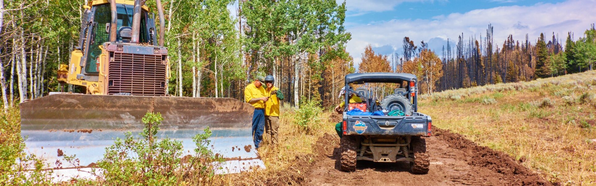
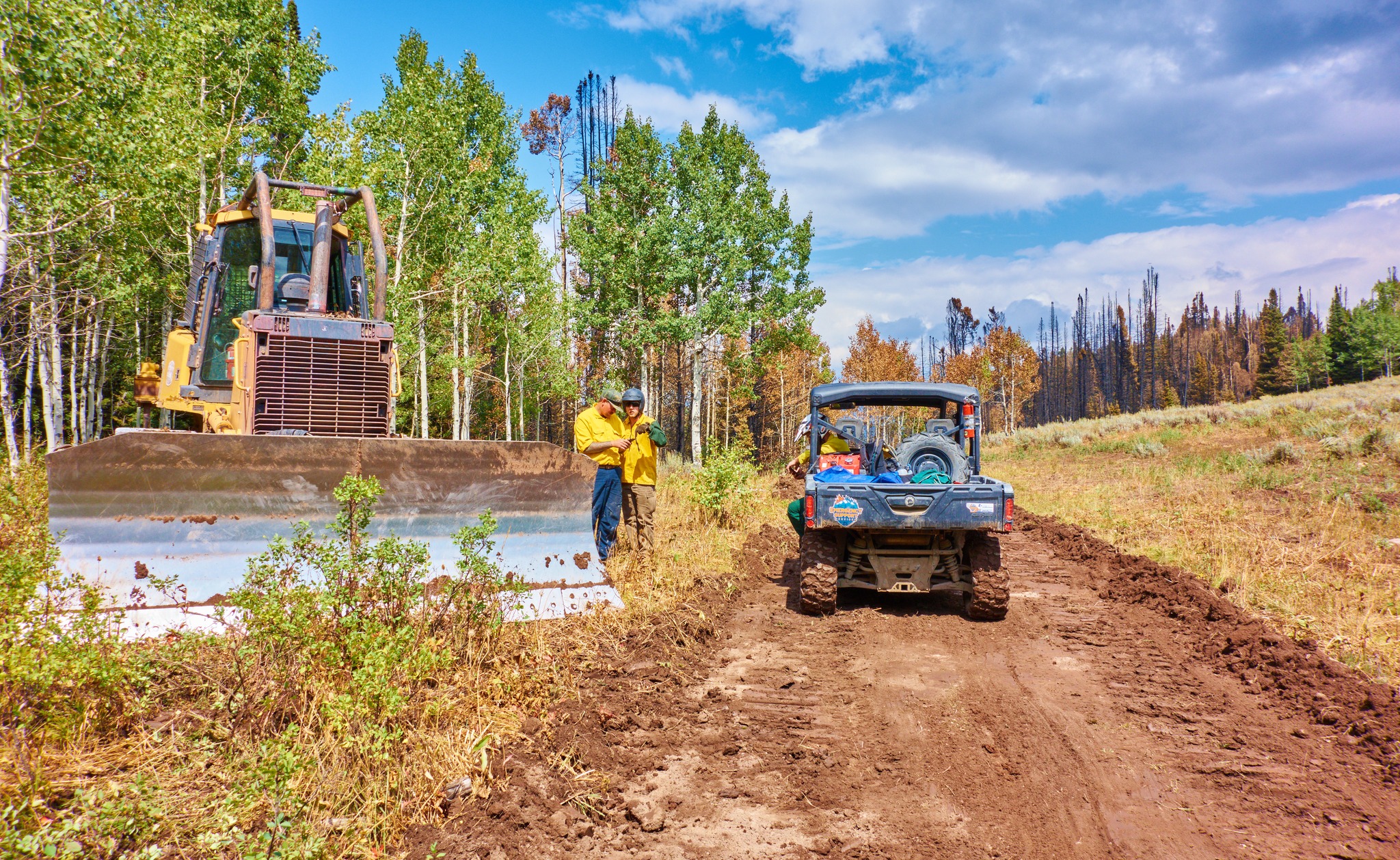
Good progress continues to be made around the fire perimeter with crews gridding for hot spots and increasing overall containment to 63%. On the north end of the fire where most of the heat remains, firefighters are utilizing helicopters to reduce heat and secure the fire’s edge. Repair of the east side dozer line continues, as well as rehabilitation of roads and trails in the fire’s interior. Due to containment on the east side of the fire and an expected downsizing in personnel, crews will begin removal of structure protection equipment such as sprinklers and hoses. In the upcoming days, the incident management team will be transferring command of the fire to Wyoming Team 3.
On Saturday, an expected 1,200 cyclists in the Lotoja bicycle race from Logan, Utah to Jackson Hole, Wyoming will be passing through the fire area on Highway 89. Motorists are advised to use extra caution to watch for cyclists as well as firefighting traffic.
WEATHER FORECAST
- Click here to view the Air Quality alert from the Riverton National Weather Service Office https://forecast.weather.gov/
wwamap/wwatxtget.php?cwa=RIW& wwa=air%20quality%20alert - Click here to view current air quality conditions https://www.airnow.gov/state/?
name=wyoming - Click here to learn more about health impacts from poor air quality https://www.wyvisnet.com/
HealthEffects.html
EVACUATION/CLOSURE INFORMATION
Lincoln County utilizes the READY, SET, GO! method. It’s important to be familiar with each stage; read the descriptions by visiting the Lincoln County Emergency Management’s Wildland Fire Action Guide at https://cms5.revize.com/…/
After aerial assessments and collaborations with Incident Management Team, ALL areas within the previously established evacuation zones have been downgraded to “READY”. Please continue to monitor the situation and keep plans in place. Future status changes will be sent from Lincoln County Homeland Security & Emergency Management. Use this linkhttps://public.coderedweb.com/
Please monitor local media and follow Lincoln County Homeland Security & Emergency Management on Facebook for more updates.
An updated forest closure for portions of the Greys River Ranger District and Kemmerer District has been issued. The defined boundary for area closure is as follows: from U.S. Highway 89 T 29 N R 119 W Section 26 running North along the 032 Trail (Packstring Creek) to the 026 trail (Driveway Creek) T 29 N R 119 W section 17, running north to the 027 trail at T 29 N R 119 W section 05, heading North East along Spring Creek to the 028 trail (Second Creek) at T 30 N R 119 W section 17, heading North East to the 073 road at T 30 N R 119 W section 09, continuing onto the 034 road at T 30 N R 119 W section 10 to the Forest/ Private boundary at T 30 N R 119 W section 03 following the Forest/ Private boundary East to the U.S. Highway 89 back to the point of origin. Smiths Fork Winter Trailhead east of U.S. Highway 89 is also closed. Within the described area, all roads and trails are closed including Allred Flat Campground.. Follow this link for full closure information: Wybtf Willow Creek Fire Incident Closures | InciWeb (wildfire.gov)
Travelers on Highway 89 should be cautious of fire vehicles and equipment in the area and are asked to not pull over or park on the side of the road to view the fire area, which could pose safety hazards to emergency personnel.
Incident Websites: Wybtf Willow Creek Fire Information | InciWeb