Willow Creek Fire now 4,356 acres at 17% containment for Thursday
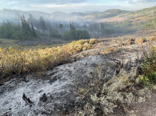
The Willow Creek Fire is coming up on a full week of burning in southwest of Smoot, Wyoming. The fire was first reported on Friday, August 22 approximately four miles southwest of Smoot. The latest update from officials are estimating the size of the fire on Thursday, August 28 is 4,356 acres. This is just one-tenth of an acre larger than the Wednesday update. Those on the scene also describe the fire at 17% containment, this is up from 12% reported on both Tuesday and Wednesday.
There will be a community meeting on Friday evening at 7 p.m. at the Afton Civic Center, located at 150 Washington St., to provide updates on the current fire behavior. Fire managers and local agency representatives will be on site to answer questions.
According to information provided by the Bridger-Teton National Forest, “crews have made progress securing more of the fire perimeter along the east side, building control lines and clearing vegetation. In addition, crews set up a “pumpkin”, which is a large collapsable reservoir, that can be filled with water, to use with the constructed sprinkler system if the need arises.”
“Crews also scouted the north perimeter of the fire to assess potential structural protection needs and continued their efforts to safeguard Allred Flats Campground. Work on the west side began, with crews building hand line off the anchor point, which is a secure point that provides a safe starting location.”
Wet weather has been part of the forecast over the past several days and more rain is expected to fall ‘Thursday but could also bring gusting winds up to 20 miles per hour.
“Because of the winds, smoke from the fire will continue to be dissipated,” the news released stated. “With the rain and thunderstorms starting to lift in the coming days, smoke from the fire will become more visible with an expected increase in fire behavior.”
EVACUATION/CLOSURE INFORMATION
Lincoln County utilizes the READY, SET, GO! method. It’s important to be familiar with each stage; read the descriptions by visiting the Lincoln County Emergency Management’s Wildland Fire Action Guide at https://cms5.revize.com/…/RSG%20Guide%20Interactive.
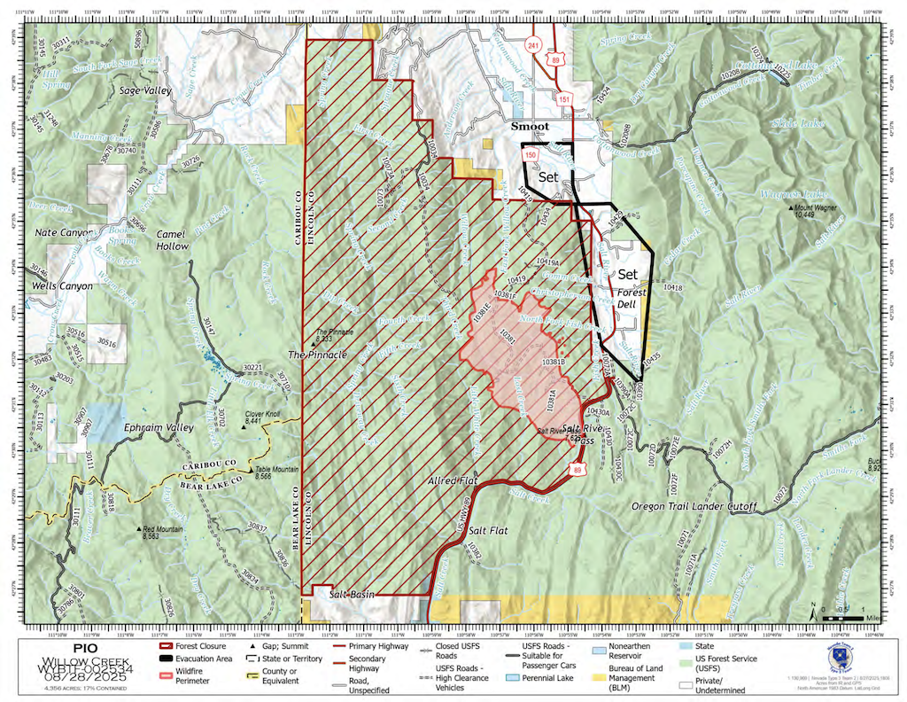
The evacuation zones remain at a ‘SET’ status. The zones are from mile post 75 south (vicinity of Gomm’s Pond Lane) to Salt Pass, and west of Highway 89 from Reeves-Schwab Lane South to Gomms Pond. Please be prepared for potential evacuation should the “GO” order be given.
The Code Red notification will be initiated by Lincoln County Homeland Security & Emergency Management. Use this link
https://public.coderedweb.com/CNE/en-US/5A0AA8D606C6 to sign up to receive notifications.
A forest closure for a portion of both the Grey River District and Kemmerer District, is still in effect. The defined boundary for area closure is as follows: from U.S. Highway 89 T29 N R 19 N Section 34 running west along the Bridger-Teton National Forest boundary (R19W R18W) to the Wyoming Idaho State line, running north along said state line to the Forest/private boundary at T 31 R 119 W section 30, following the Forest/private boundary SE to its intersection with U.S. Highway 89, running along the west edge of U.S. Highway 89 back to the point of origin. Smiths Fork Winter Trailhead is closed. Within the described area , all roads and trails are closed including Allred Flat Campground. Follow this link for full closure information: https://inciweb.wildfire.gov/incident-closures/wybtf-willow-creek.
Travelers on Highway 89 are advised to use caution due to fire vehicles and equipment in the area. Please do not stop or park along the roadside to view the fire area, as this can create safety risks for emergency personnel.
Please monitor local media and follow Lincoln County Homeland Security & Emergency Management on Facebook for more updates.
Incident Websites: https://inciweb.wildfire.gov/incident-information/wybtf-willow-creek.