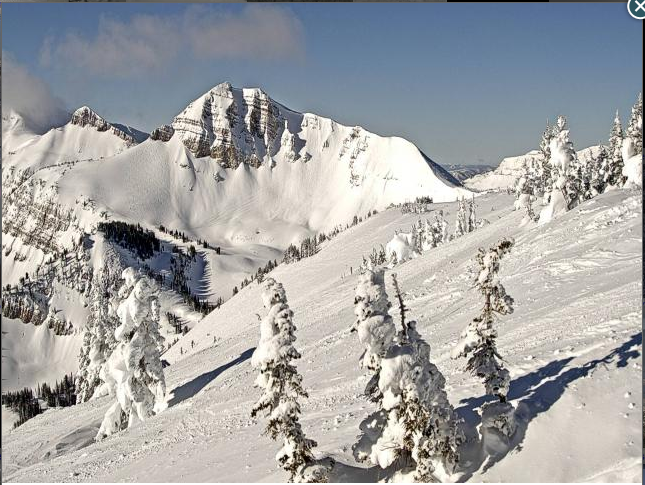
◆ Lincoln County has wide range of moisture levels.
May arrived with warming temperatures and sunny days in Western Wyoming. The spring weather showcased a wide range of moisture levels throughout Lincoln County as the winter season officially wrapped up.
“The Snake River Basin’s snowpacks’ water content as of May 1, which included the Salt and Greys River drainages, as a whole, was 116 percent of median for this time of the year,” said DeMont Grandy, natural resource specialist. “The Salt River drainage snowpacks range from a high at the Willow Creek Snotel Site at 148 percent of median to a low at the Grover Park Divide manual snow course site at 0 percent of median, since it was melted out. The low elevation snowpacks are pretty much melted out, which is normal for this time of the year.”
“The Greys River drainage high elevation snowpacks ranged from a high at the Blind Bull Snotel Site at 126 percent to a low at the Spring Creek Divide Snotel Site at 113 percent of median,” Grandy continued. “The high elevation snowpacks haven’t started to meld yet.”
According to the Natural Resource Conservation Service, the Greys River, as of April 1, was predicted to flow 111 percent of average. The Salt River near Etna was predicted to flow 122 percent of average. The Palisades Reservoir was 90 percent of capacity.

“The Upper Bear River Basin’s snowpacks, as a whole on May 1, were 89 percent of median,” Grandy said. “This is likely the result of low precipitation events in the Cokeville area during the month of April.”
“Due to Lincoln County’s length, precipitation varies substantially through the county,” Grandy added. “Snowpacks in the Cokeville area ranged from a high at the Salt River Snotel Site at 110 percent of median to a low at the Kelley Ranger Station Snotel Site at 89 percent of median. The head waters of the Bear River snowpacks ranged from a high at the Monte Cristo Snotel Site at 89 percent of median to a low at the Hayden Fork Snotel Site at 85 percent of median.”
According to the Natural Resource Conservation Service, the Smiths Fork River near Cokeville, as of April 1, was predicted to flow 109 percent of average. The Bear River near Woodruff, Utah, was predicted to flow 91 percent of average. Woodruff Narrows Reservoir was 109 percent of capacity.
“As of May 1, the Lower Green River Basin’s snowpacks’ water content, as a whole, was 93 percent of median,” said Grandy. “The Hams Fork River drainage snowpacks ranged from a high at the Indian Creek Snotel Site at 90 percent of median to a low at the Hams Fork Snotel Site at 79 percent of normal. Snowpacks have been down in the Hams Fork drainage due to varied precipitation events in the high elevations throughout the year.”
According to the Natural Resource Conservation Service, as of April 1, the Hams Fork River below Pole Creek was predicted to flow 80 percent of average. Viva Naughton reservoir was at 67 percent of capacity.
“It has been an interesting water year so far,” said Grandy. “The lower elevations throughout Lincoln County received abundant amounts of snow. The middle and high elevation snowpacks were close to median or slightly higher for most of the year. The lower elevation snow finally melted out. The middle elevation snowpacks are starting to melt. The high elevation snowpacks haven’t started to melt for the most part.”
“If it remains relatively cool, snowpacks should melt out without a lot of flooding,” Grandy continued. “If it turns really warm, with heavy rain fall, flooding could be a problem. The months of May and June need rain fall to get the lowland rangeland vegetation to grow. It is a delicate situation to have the right amount of rain fall that does not contribute to flooding problems. Mother Nature can be ruthless at times, hard to predict or understand.”