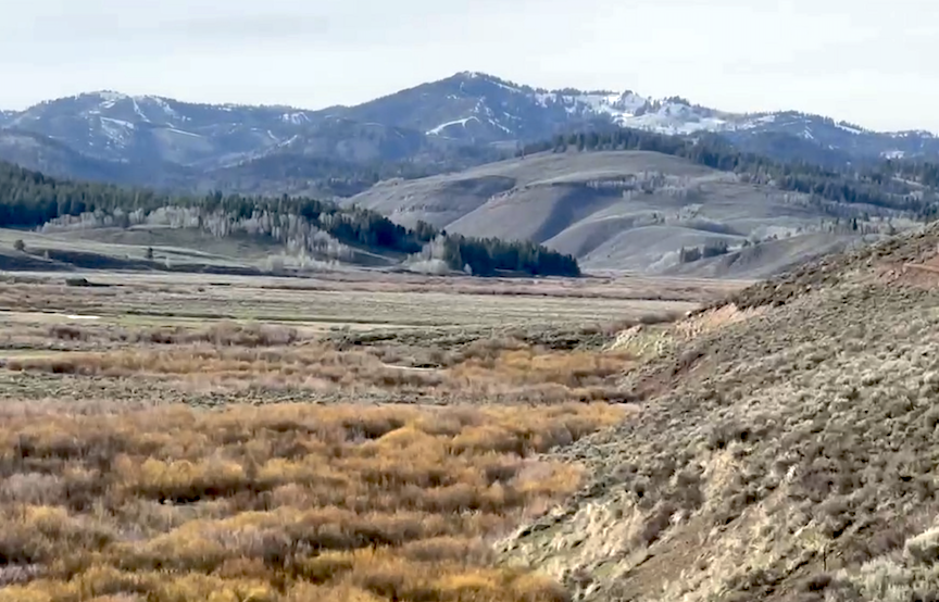
early April. Water levels, traditionally running high in the streams around Star Valley, are abnormally low for the this time of
year. SVI PHOTO/DAN DOCKSTADER
By DeMont B. Grandy,
Natural Resource Specialist, LCD
It has been a disappointing year for snowpacks. Currently, most snowpacks are melted out except some high elevation snowpacks remain mainly due to the cold weather being experienced lately. Because of the warm weather we had last fall and winter, a lot of moisture received was in the form of rain. Currently, the Snake River Drainage Basin overall precipitation is 106 percent of median since the start of the water year on October 1, 2025. The Upper Bear River Drainage Basin overall precipitation is 98 percent of median, while the Lower Green River Drainage Basin overall precipitation is 88 percent of median. It has been a disastrous year for most snowpack accumulations, which affects stream and river high water flows, which fill our reservoirs and provide the majority of irrigation water. Many rivers are already under regulation a good couple of months early. It is likely most local streams and rivers will have a normal amount of sustained flows until possibly July due to good ground water levels, but after July water levels could substantially drop if no precipitation is received. It has been a very abnormal year so far.
This will be the last year’s report on local snowpacks. As of May 4, 2026, the Snake River Drainage Basin’s Snowpacks” Snow Water Equivalent (SWE), as a whole, was 62 percent of median, lower than last year’s median of 93 percent. The Salt River Drainage Basin’s SWE ranged from a high at the Willow Creek Snotel Site at 50 percent of median, snow depth 31 inches to a low at several snow course sites that had melted out. The Greys River Drainage Basin’s snowpacks’ SWE ranged from a high at the Blind Bull Summit Snotel Site at 100 percent of median, snow depth 51 inches to a low at the Spring Creek Snotel Site of 94 percent of median, snow depth 57 inches.
The most probable water flow prediction for the Salt River, as of April 1 at Etna, WY was around 61 percent of median, while the Greys River at Alpine, WY was 75 percent of median. Jackson Lake was 77 percent of capacity.
The Upper Bear River Drainage Basin’s snowpacks’ SWE, as a whole May 4, 2026, was 34 percent of median, substantially lower than last year’s median of 69 percent. The snowpacks’ SWE in the Cokeville, WY area for this time of year, ranged from a high at the Big Park Manual Snow Course at 49 percent of median to a low at the Salt River Summit Snotel Site which had melted out. The head of the Bear River snowpacks’ SWE ranged from a high at Trial Lake Snotel Site at 46 percent of median to a low at
Lily Lake Snotel Site which has melted out.
As of April 1st, the most probable water flow prediction for the Bear River near Woodruff, UT was near 45 percent of median. The Smiths Fork River near Border, WY most probable water flow prediction was near 60 percent of median. The Woodruff Narrows Reservoir was 31 percent of capacity.
The Lower Green River Drainage Basin’s snowpacks’ SWE, as a whole for May 4th, this year was 29 percent of median compared to last year’s 66 percent of median. The snowpacks’ SWE in the Upper Hams Fork River Drainage Basin ranged from a high at the Indian Creek Snotel Site at 67 percent of median, snow depth 34 inches, to a low at the Hams Fork and Kelley Ranger Station Snotel Sites which have melted out. The Hams Fork River Drainage Basin’s snowpacks’ SWE ranged from a high at the Steel Creek Park Snotel Site at 44 percent of median to a low at the Hewinta Snotel Site which has melted out.
As of April 1st, the Hams Fork River below Viva Naughton Reservoir most probable flow was predicted to flow 58 percent of median. Viva Naughton Reservoir, as of May 4th, was 97 percent of capacity.
It has been a year to remember. Hopefully, precipitation amounts will increase resulting in a wetter spring and summer. Currently, most of Southwest WY is in a severe drought category. Remember, the drought trend that now exists may take a couple of years to change. It is very important that water use is done wisely.
Individuals wanting more snowpack or water forecast information may contact the Lincoln Conservation District (LCD) Field Office at (307) 279-3256 Ext. 3 or the Wyoming State Engineer’s Office in Cokeville at (307) 279-3441. A tabulation worksheet of daily statewide Snotel site measurements may be taken off the internet at www.wrds.uwyo.edu/wrds/nrcs/